The North Dakota Neighborhood Explorer helps you to research any North Dakota neighborhood (census block group) and get home values, average household income, owner/renter/ occupancy rates, projected growth rates, boundary maps, comparisons to other communities, and much more.
North Dakota State Flower - Wild Prairie Rose
The United States acquired most of the area of North Dakota from France in 1803 as part of the Louisiana Purchase. It obtained the area in the north and northeast part of the present-day state by a convention, signed with Great Britain in 1818 that extended the northern boundary along the 49th parallel. Dakota Territory was organized on March 2, 1861, from unorganized area formerly within Minnesota Territory and part of Nebraska Territory. Dakota Territory included all of the present-day states of North Dakota and South Dakota, most of Montana, the northern half of Wyoming, and a small part of Nebraska. The territory was reduced in 1863 with the organization of Idaho Territory, enlarged in 1864 with the addition of most of the remainder of present-day Wyoming, and again reduced with the organization of Wyoming Territory in 1868. In 1882, the state of Nebraska acquired an area north of the Keya Paha River and Niobrara River. North Dakota was admitted to the Union simultaneously with South Dakota on November 2, 1889, as the 39th and 40th states, with generally the same boundaries as the present states.
Census data for the combined area in present-day North Dakota and South Dakota are available in the 1860 census (and listed in national tables with South Dakota). The 1860 census population is for territory reported as "unorganized Dakota" and includes population in areas now in Montana. The 1860 population excludes some population enumerated in Nebraska Territory. Although the state had not yet been legally established, the 1870 and 1880 populations generally are for the area of the present state. The population of Dakota Territory as legally established was 135,177 in 1880 and 14,181 in 1870.
Data for the legally established state of North Dakota are available beginning with the 1890 census.
See: Geographic Terms & Concepts
Interactive Map of North Dakota Counties | Static Overview Map of North Dakota Counties
There are 53 counties in North Dakota. All counties are functioning governmental units, each governed by a board of county commissioners.
-- Select County --
Adams County
Barnes County
Benson County
Billings County
Bottineau County
Bowman County
Burke County
Burleigh County
Cass County
Cavalier County
Dickey County
Divide County
Dunn County
Eddy County
Emmons County
Foster County
Golden Valley County
Grand Forks County
Grant County
Griggs County
Hettinger County
Kidder County
LaMoure County
Logan County
McHenry County
McIntosh County
McKenzie County
McLean County
Mercer County
Morton County
Mountrail County
Nelson County
Oliver County
Pembina County
Pierce County
Ramsey County
Ransom County
Renville County
Richland County
Rolette County
Sargent County
Sheridan County
Sioux County
Slope County
Stark County
Steele County
Stutsman County
Towner County
Traill County
Walsh County
Ward County
Wells County
Williams County
North Dakota has 1,765 county subdivisions which are minor civil divisions (MCDs). There are 1,317 townships which are functioning, but not necessarily active, governmental entities. Townships are governed by a board of township supervisors. Rushville township, Ward County is inactive. There are 357 incorporated places which are independent of MCDs and serve as 364 county subdivisions. There are also 84 unorganized territories. Billings, Dunn, Mercer, Oliver, and Stark Counties have no townships and are covered entirely by unorganized territories or cities independent of any MCDs.
North Dakota State Bird - Western Meadowlark
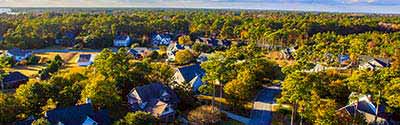
North Dakota has 401 places; 357 incorporated places and 44 census designated places (CDPs). The incorporated places are all cities. There is no minimum population for incorporation in North Dakota. All incorporated places are independent of county subdivisions.
Alphabetical List of Cities, Towns, CDPs and Other Populated Places A | B | C | D | E | F | G | H | I | J | K | L | M | N | O | P | Q, R | S | T | U, V | W, X, Y, Z
North Dakota Civil Features : Political Subdivisions, Native Areas, Land Grants, etc. - sorted by Census Class Codes .
There are 2 Metropolitan and 5 Micropolitan Statistical Areas in North Dakota. ND Metopolitan & Micropolitan Areas
There are 393 ZIP Code tabulation areas (ZCTAs) in North Dakota. View North Dakota ZIP Codes and ZIP Code Maps .
North Dakota has 29 elementary school districts and 155 unified school districts. View North Dakota Public and Private Schools .
North Dakota has 1 congressional districts. An interactive map shows the contact information for each Representative as well as the boundaries for each North Dakota district. View Map of North Dakota Congressional Districts .
There are 47 state senate districts and 47 state house districts in North Dakota.
North Dakota has five federally recognized American Indian area reservations, two with off-reservation trust land.
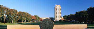
The town of Rugby is the geographical center of North America.